Ships moving from the Atlantic to the Pacific through the Panama Canal in Panama must climb about 26 meters to cross a ridge of land, but they also deal with a smaller difference at the ends. The Pacific side sits roughly 20 cm higher than the Atlantic side. This happens because of tides, winds, and ocean currents that keep the levels uneven despite the oceans connecting around South America.
Background
The Panama Canal cuts 82 kilometers across the Isthmus of Panama to link the Atlantic and Pacific oceans. It opened in 1914 after years of work. France started digging in the 1880s but stopped due to deaths from disease and tough ground. The United States took over in 1904 and finished the job ten years later.
Workers faced swamps full of mosquitoes that spread yellow fever and malaria. Thousands died in the early efforts. The US brought in doctors who drained water, sprayed oil on ponds, and screened buildings to fight the bugs. This cut deaths and let the project move ahead.
Engineers chose locks over a sea-level cut because the land rises in the middle. They dammed the Chagres River to make Gatun Lake, an artificial body of fresh water 26 meters above sea level. This lake cuts down on digging by letting ships float high across the divide.
Tides play a big part in the ocean levels at the canal. On the Pacific side near Balboa, tides reach up to 4.7 meters high and drop to 0.5 meters low. Over on the Atlantic side at Cristobal, tides only go up 0.3 meters and down to -0.1 meters. This big swing on the Pacific—up to 20 feet at times—lifts the average water level there.
Back in 1883, builders noted this tide gap. They saw it could make ships hard to handle without controls. So they planned locks to hold steady water levels inside the canal from the Pacific entrance to Colon on the Atlantic end.
Key Details
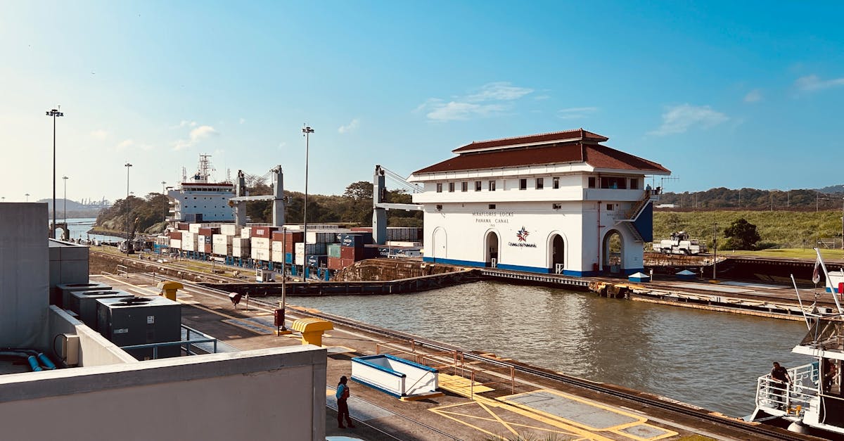
The canal uses a set of locks at each end. On the Atlantic side, three locks called Gatun lift ships 26 meters to Gatun Lake. Ships cross the lake, then go through Pedro Miguel Lock down 10 meters, across Miraflores Lake, and through two Miraflores Locks to drop the rest to the Pacific.
How the Height Difference Works
At the canal entrances, Pacific water stays about 20 cm higher than Atlantic water. This comes from denser Atlantic water, steady trade winds pushing Pacific water toward shore, and currents around Cape Horn at South America's tip. Water flows from Pacific to Atlantic there, but friction and Earth's spin keep levels from evening out fast.
Inside the canal, locks keep water at a fixed height. Each ship passage uses 200 million liters of fresh lake water, poured into the locks to raise vessels. This water flows one way to the sea and does not mix back.
The canal handles about 35 ships a day when water is full. Droughts cut that number, as seen in 2023 when low rain dropped it to 22 ships. Rain fills the lake, so dry spells from events like El Nino slow traffic.
"The Pacific Coast is higher than the Atlantic, but the canal's design overcomes this," said Rita Dovran, a shipping manager who plans vessel passages.
Ships bid for slots or book ahead. When the canal backs up, some go around Africa's Cape of Good Hope, adding weeks and burning extra fuel.
What This Means
The height setup shows how local forces shape global waters. Tides pull stronger on the Pacific side because of its wide basin and moon's pull. Winds from the west pile water against Panama's coast. These factors hold the 20 cm gap steady over time.
For shipping, the locks make the shortcut work. Without them, strong Pacific tides would rush in and out, making navigation risky. The steady canal level lets big vessels pass safely, saving trips around South America.
Climate shifts bring new issues. Less rain from warmer patterns means lower lake levels more often. Officials talk of a new reservoir, but that could move 2,000 people and stir environmental concerns. No plans are set.
The canal moves goods worth billions yearly. It links US East Coast ports to Asia faster. Delays there ripple to store shelves worldwide. Keeping water steady matters for trade and food prices.
Panama runs the canal through its authority. They widen parts for bigger ships and fix locks. The old system from 1914 still works because it matches nature's quirks, like the higher Pacific side.
Daily tides shift levels a bit, but locks adjust. Gauges track the difference, and operators open gates when safe. This balance lets 14,000 ships pass each year without the oceans fully leveling at the canal.
The setup proves engineering bends to Earth's ways. Builders saw the tide range and ridge height early. They built around both, creating a path that lasts over a century.