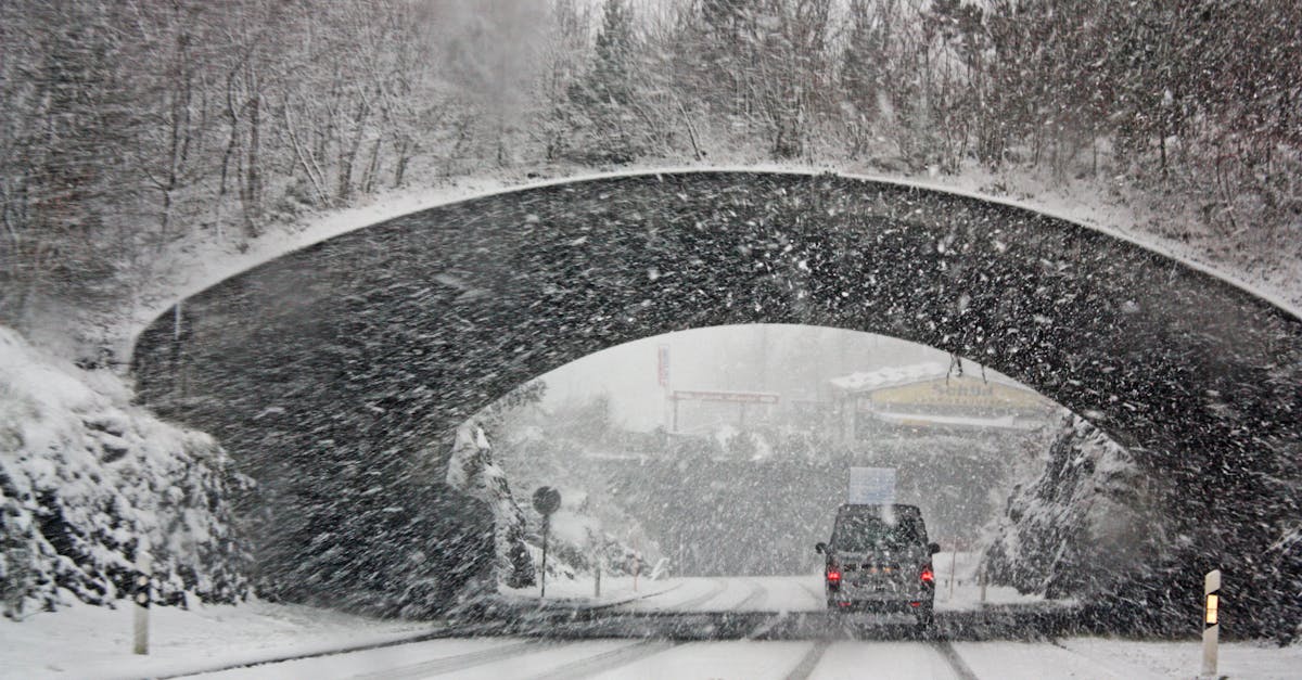
A massive winter storm is moving across the United States, hitting 18 states from New Mexico to Maine with heavy snow, ice and freezing rain. More than 180 million people are under alerts as the storm started Friday afternoon and will peak on Saturday, leading to emergency declarations, flight cancellations and preparations for power outages.
Background
This storm began building on Friday in New Mexico and the Texas panhandle, where snow and ice first fell. By evening, areas like Dallas saw a mix of winter weather, and Oklahoma City got some snow. The system grew quickly, spreading east and north over the weekend.
Governors in at least 18 states have declared states of emergency to free up resources for response. Federal offices in the Washington, D.C. area will close on Monday. Public schools in D.C. are already set to shut down that day for staff training, which lines up with the storm's timing.
The storm comes during a cold snap that will linger in parts of the South. Cities like Dallas, Little Rock in Arkansas and Memphis in Tennessee face below-freezing temperatures even after the main storm passes. This raises worries about people losing heat if power goes out.
Over 8,300 flights have been canceled through the weekend, with more than 2,300 scrapped just for Saturday. Hundreds of flights out of Massachusetts were grounded as snow built up there too.
Key Details
Storm Path and Forecast
Saturday stands out as the worst day, especially for ice in the South. Morning snow and ice will cover Texas to Arkansas and Tennessee. By afternoon, snow will fall from St. Louis to Indianapolis, Cincinnati and Charleston in West Virginia.
Evening brings snow and ice from New Mexico to the Carolinas. Further south, freezing rain or a wintry mix hits Dallas, Shreveport in Louisiana, Memphis, Raleigh in North Carolina.
On Sunday, the storm shifts east. Snow will reach from Wichita in Kansas to Cincinnati, Washington, D.C. and Philadelphia. Freezing rain becomes likely by morning in Houston, Memphis, Atlanta and Raleigh.
By noon Sunday, snow arrives in New York City, while D.C. sees a shift to wintry mix. The path along Interstate 95 from D.C. to New York remains uncertain for snow versus mix, but most of New England and inland Northeast will get steady snow Sunday into Monday.
Snow totals reach 3 to 6 inches across a wide area from New Mexico through the Ohio Valley to Maine. Heavier amounts, up to a foot or more, are forecast from the Texas panhandle to southern Missouri, the Ohio Valley, Appalachians and New England. Coastal areas from Virginia to southern New England expect 6 to 12 inches, with New York City at 8 to 12 inches.
Ice buildup could hit 1 inch or more in spots in Mississippi and western Tennessee. This ice will make roads unusable for days and snap power lines.
Response Efforts
The Federal Emergency Management Agency has supplies ready. At Camp Minden in Louisiana, teams have staged 250,000 meals, 400,000 liters of water and 30 generators. Incident management teams wait on alert, and the National Response Coordination Center is active. Twenty-eight urban search and rescue teams stand by to help if governors call them in.
In Washington, D.C., Mayor Muriel Bowser said the city declared an emergency for ice and what could be the biggest snowfall in years.
"Current projections have at least nine inches of snow falling, with the potential for more," Bowser said. "There is a possibility of freezing rain overnight Sunday into Monday, which will increase hazardous conditions."
The city asked the D.C. National Guard for vehicle help so first responders can get around.
Travel remains dangerous. Ice will keep roads slick for days, and people should avoid driving if possible. Power outages from ice are likely, leaving homes without heat during the cold.
What This Means
Roads across the South could shut down for days from ice, stranding drivers and blocking emergency vehicles. Power failures mean no lights, heat or water pumps in many homes, especially where outages last through the cold spell.
Air travel grinds to a halt, affecting millions heading home or on trips. Businesses in the storm path may close, and schools will stay shut into next week in hard-hit areas.
Farmers and rural areas face crop damage from heavy snow and ice weights on trees and lines. Coastal spots prepare for any wind or flooding mixed with the snow.
The storm tests emergency plans nationwide. States coordinate with federal teams to clear roads, restore power and shelter those in need. Cold after the storm adds risk for anyone outside or without power.
Residents stock up on food, water and blankets. Crews plow highways and salt streets around the clock. The full impact will show in coming days as cleanup starts and damage reports come in.